Pages

Tuesday, July 30, 2013

Alaska - Our trip during July, 2013 - Part IV

Wednesday, the 17th July:

For this day, we had booked tickets for a cruise ride at Whittier, 88 miles away from Seward (and 60 miles South of Anchorage). Whittier sits at the head of the Passage Canal. We drove back on the Seward highway until we reached Turnagain Arm of Cook Inlet and then into Portage glacier road. There is a 2.5 miles long Anton Anderson Memorial railroad tunnel (locally known as the Whittier tunnel or Portage tunnel), through the Maynard Mountain hills, just before Whittier.

Whittier tunnel, along with the port at Whittier, was built as a military facility during the Second World War by the U.S. Army. It is the second longest highway tunnel, and longest combined rail and highway tunnel, in North America. It links the Seward highway south of Anchorage with Whittier and is the only land access to the town. The tunnel is named after the army engineer who supervised construction of the rail spur through Maynard Mountain. The tunnel is a critical bottleneck. It allows traffic to flow from one side to the other, allowing 15-minutes slot for the vehicles and another 15-minutes slot for the train. That meant, once in an hour, you got a 15 minute slot to cross through the tunnel. We couldn’t afford to be late, so we had started from our hotel at Seward quite early and we were there in front of the tunnel just five minutes before the suggested 10.30 AM slot for our crossing-over.

Whittier is just a small port town with a population of less than 300 most of who stay in one big building. The spur of the Alaska Railroad to Camp Sullivan, as the place was originally named by the army, was completed in 1943 and the port became the entrance for U.S. soldiers into Alaska. The port remained an active army facility until 1960. The two huge buildings that dominate Whittier were built after World War II. The 14-story Hodge building, now known as Begich Towers, was built for housing solders and the Bucker Building, completed in 1953, was called the ‘City under one roof.’ Both these buildings were at one time the largest buildings in Alaska. The Begich building is now a condominium housing nearly all the Whittier’s residents. Whittier was incorporated in 1969. Tsunamis triggered by the 1964-Good Friday Earthquake severely damaged the town, including the now abandoned Bucker Building. Whittier is a popular port of call for cruise ships. Whittier is also popular with tourists, sport fishermen and hunters. The Whittier Glacier near Whittier was named for the American poet John Greenleaf Whittier in 1915.

We boarded the 12.30 PM 26-Glacier Cruise. The cruise ship, we were told, would help us explore glacier carved Fjords, ancient ice and towering mountains of the Chugach National Forest. A quick reference to Google described a Fjord (pronounced as F’eord – the letter ’j’ being silent, also spelled as ‘fiord’) as: “a long, narrow inlet with steep sides or cliffs, created in a valley carved by glacial activity.” I learn that the coasts of Norway, Iceland and Greenland have many fjords.

Some more interesting information about Whittier: Long before Westerners arrived, Chugach Eskimos, now known as Alutiq, crossed the pass that separates Prince William Sound from the Cook Inlet’s Turnagain Arm in search of fish, almost 7000 years ago, as the glaciers began to retreat. Miners later took the route to reach the gold fields of Turnagain Arm. In Geography, a Sound or Seaway is “a long, relatively wide body of water, larger than a strait or channel, forming an inlet or connecting two large bodies of water, such as two seas, or a sea and a lake.” The Chugach Eskimos were water people whose lives centered on hunting and fishing. The Eyak, who shared the Sound, were people of the shore who came from Alaska’s Interior. These early people created small villages and lived in wooden houses. They made clothing from sea otter and seal, wove baskets from grass and spruce roots and used stones, bones, wood and shells to make tools. Today, about 1000 Alaska Natives live in the Sound where their lifestyles range from traditional subsistence to leading major Alaska Native-owned corporations.
Some of the greatest explorers who visited the Sound include:
·        Vitus Bering, a Danish navigator who served in the Russian Navy and who discovered Alaska in 1741,
·        George William Stellar, the famous German Naturalist, a member of the Bering Expedition, which made landfall at Kayak Island, approximately 100 miles southeast of Whittier. Many living species are named after Stellar: Stellar Sea Lion, Stellar Jay, Stellar Eider and Stellar Sea Eagle, and
·        Capt. James Cook who entered the Sound on May 12, 1778. While he traded with the area’s indigenous people, William Bligh – later of the Mutiny of the Bounty fame – took a small boat and paddled long enough to determine it was not the Northwest Passage. It was Bligh Reef that the Exxon Valdez struck in 1989.

That day’s 145-miles journey on the cruise aboard the largest, fastest catamaran in Alaska took us through rugged wilderness, towering glaciers and pristine waters.
Prince William Sound is 2100 square miles of islands and fjords, carved by 15 million years of glaciations and surrounded by the Chugach National Forest. It is America’s largest intact marine ecosystem and North America’s northern-most rain forest.  It is also one of the most active seismic regions in the world. The journey took us near the epicenter of the 1964 Good Friday earthquake that measured 9.2 on the Richter scale.

From Whittier, the cruise headed east through Passage Canal to the Egg Rock sea lion rookery in Port Wells. We continued to scenic Esther Passage where only small ships can navigate. High mountains protect this narrow channel from rough seas and winds. Many animals call this area home. Bald eagles are frequently seen fishing. Orcas are common and sea otters are almost always present. Beyond Esther Passage, the vessel headed north in College Fjord, a glacier-rich region whose namesake came from a science expedition led by American railroad financier Edward Harriman. The team named each glacier along the northwest side of the fjord after prominent women’s colleges, while those on the southwest side were named after men’s colleges. Next we cruised to Barry Arm and Surprise Glacier in Harriman Fjord. The cruise plotted a path through the ice-filled waters up to the front of the glacier so we could watch for ice calving into the sea. The ship made the last stop at the kittiwake bird rookery just across the bay from Whittier. It is reported that more than 10000 birds inhabit these rocky cliffs each summer laying eggs, fishing and teaching young hatchlings the survival tips they will need before they fly south for winter.
Our routes took us past three types of glaciers found in Alaska:
1) Tidewater Glaciers: Pressured by their own weight, active tidewater glaciers move toward the water, ending at the ocean’s edge where they frequently ‘calve,’ shedding slabs of ice that crash into the sea. These floating icebergs are so heavy that only the very tip is visible.
2) Piedmont Glaciers: These glaciers rest at the base of the mountain. They are formed when glacial ice forms a fan-shaped mass at the foot of the mountain range.
3) Alpine Glaciers: Also known as hanging glaciers, these ice masses start high on the slopes of mountains, and literally ran from the mountainsides.

We also learnt that the areas surrounding our journey are habitat for more than 1645 animal species, some of the important species being: Sea otter, Harbor seal, Ribbon seal, Stellar sea lion, Black-legged kittiwake, Eagle, Black bear, Mountain goat, Dall’s porpoise, Orca/Killer Whale, Humpback whale and Minke whale.


The journey on the cruise was exhilarating. It was a great experience standing on the deck outside the cruise ship, and facing the strong wind. We saw glacier after glacier, otters, eagles and many more. Lunch was provided in the cruise and it was just okay. When the journey was about to end, the Forest Ranger who was conducting the tour gathered all the small children, administered a pledge to all of them and presented a Junior Forest Ranger Badge to every one of them. Sanjay was once again very proud. We were back at the harbor at 05.30 PM. We, immediately, rushed to our vehicle to get back through the tunnel and drove all the way to Talkeetna, north of Anchorage, on our way to Denali National Park, our last destination in our Alaska tour.

………..to be concluded in Part V

Sunday, July 28, 2013

Alaska – Our Visit during July, 2013 - Part III

Tuesday, the 16th July:

Seward is situated at the head of Resurrection Bay on the Kenai Peninsula and is known as the ‘Gateway to Kenai Fjords National Park.” Seward is a picturesque town with a bustling harbor. The Seward highway connecting Anchorage with Seward has been named an All-American Road, which is the highest designation of a National Scenic Byway.

In the morning, Sanjay and I left for the riverside. It was just opposite to our hotel. Actually, we wanted to get into the river to play in water, but there was no secure arrangement and so Sanjay for disappointed.


We returned back after taking pictures and spending some time in the spectacular restaurant located near the front desk at the hotel.

Meanwhile, Viji had prepared some delicious ‘rajma’ and rice for our lunch. We had cereals for our breakfast. We left our hotel to reach the visitor centre for Exit glacier and after collecting necessary information brochure, we began our hike.
We managed Sahana in the stroller for some distance, but the smooth pavement ended soon and we had to hike carrying Sanjay, Sahana and the stroller, through rough uneven rocky route. We shed weight by discarding the stroller to one corner on the way. Viji carried Sahana on her back, and I carried Sanjay on my back. We quickly moved forward. We stopped near a small bridge on the way to take some rest before we hiked further. It became colder and colder as we went closer and closer to the glacier. There was strong, chilly wind blowing in our direction. We reached the penultimate view point before the glacier and from there we had wonderful view of the valley down and the glacier up the hill. Sanjay and I went further up to the final view point that was very close to the glacier. It was freezing cold there and worsened by cold winds. The glacier looked beautiful in semi-bluish in color and at the same time very scary too.


An information board kept there, revealed that the glacier had been receding or shortening in its length over years, probably indicating global warming.


While returning back to the visitor centre, some visitors whom we met on the way reported that they spotted a bear in the woods area and they cautioned us to go carefully. However, we saw no bear and we were back safely at the visitor center. While we were looking at a few souvenirs displayed for sale, Sanjay attempted some puzzle in a book gifted to him by the Ranger staff in the visitor center. For successfully completing the puzzle, Sanjay was presented with a Forest Junior Ranger Badge and was administered the Junior Forest Ranger’s pledge. It was funny watching Sanjay taking the pledge without opening his mouth. But he was visibly proud that he had received the Badge. We went back to the hotel for our lunch.

In the evening, we left for the bay area. Sanjay and Sahana played for sometime in a park and we didn’t have much activity to do except watching the bay and the moving, small ships and speed-boats.
Suddenly, Viji had an idea. She suggested that we could drive up to Cooper Landing on the Seward highway to see Kenai River and Kenai Lake. It was a 47 miles drive on the way to Anchorage.

It was late in the evening when we reached the quiet Kenai Lake. The lake was desolated, but for a lady and her small child. The lady patiently watched her two-year-old son playing with pebbles near the water. She carried a gun on her belt and that scared us. But she was nice, she lived there and she gave us very useful information about the place. On her suggestion we drove a little up on the main road to reach a bridge across the Kenai River from where we could get excellent view. The river and its blue water with the backdrop of the hill offered scintillating view. It was past 8.00 PM and someone was just beginning his lonely river-rafting. He must be a daredevil, we thought.


After taking several pictures, we returned back to our hotel, had our dinner and went to sleep.

The hotel we stayed was located in a beautiful, spacious campus with plenty of trees, flowers and plants.


..................... continued in Part IV
   

Thursday, July 25, 2013

Alaska - Our visit during July, 2013 - Part II

Part II
Sunday, the 14th July:
We spent our forenoon at the Science Centre at Anchorage. The children enjoyed the several scientific exhibits playfully. Sanjay and Balaji went for a ‘dinosaur show’ while we went for ‘Northern lights’ show in the planetarium theatre.
Alaska is known for the Northern Lights – Aurora, a strange phenomenon of a natural display in the sky particularly in the high latitude (Arctic and Antarctic) regions, caused by the collisions of energized charged particles with atoms in the high altitude atmosphere (thermosphere).


We also went around the Science Centre looking at various exhibits about life in Alaska, its history and heritage and later developments.


In the evening we went for buying souvenirs from a gift-store. Later, we walked along the Downtown hoping to catch the entry to the walking/biking/hiking trail along the bay, but we couldn’t locate it. And so, we spent our time in a few parks, the children enjoying their park time more than our planned hike.
Monday, the 15th July:
We vacated from our hotel after our breakfast and headed towards Seward. We took the same scenic Seward highway along the Turnagain Arm.

On the way, we stopped for hiking to Flattop Mountain. This is a 3510 feet high mountain forming part of Chugach State Park, with an elevation of 1280 feet from the parking lot. It was generally cloudy and misty around the mountains. There are several levels to climb on this mountain. One could walk or bike.


We could view Anchorage from the first level. We went up to the second level too. Lakshmi and Sahana stayed back. We couldn’t try to hike to third and further levels for want of time. Besides, Sanjay started complaining about his hurting legs. After all, he was just four years old.
From the Flattop Mountain, we drove further on the Seward highway and on the way we stopped to view a small waterfall. We drove all the way to the end of Turnagain Arm and then to the other side of the Arm and then towards South to reach Seward. The drive on the other side of Turnagain Arm was really very scenic with mountains, rivers, and lakes. Two of the important places we passed through were:

·        Moose Pass situated on the shores of Upper Trail Lake 30 miles outside of Seward. Iditarod trail begins here and was used to transport gold and supplies. There is abundance of moose in the area and prompted the name for the place.

·        Cooper Landing, considered as the ‘Gem of the Kenai Peninsula’, ‘a Emerald’ in summer and ‘a Diamond’ in the Winter, is one of the finest, most diverse outdoor recreation area Alaska has to offer. Conveniently located in the middle of the Kenai Peninsula, nestled in the majestic Kenai Mountains along the beautiful turquoise waters of Kenai Lake and the upper Kenai River. These waters are uniquely tinted blue-green by suspended ultra-fine glacial silt. Fishing, rafting, hiking, sightseeing, horseback riding, mountain biking, sea kayaking, and gold panning are popular activities of the place.


We reached Seward in the evening. Our stay was arranged at Windsong Hotel on the banks of the Resurrection River. The view of the distant mountains, some of them snow-capped, from the banks of the river was mesmerizing.

                                                                                                                          ………………..Continued in Part III

Alaska: Our visit during July, 2013


Introduction
I love travelling and visiting places. To visit Alaska was one of my lifetime dreams. I dream a lot and aspire a lot. Obviously, I still have many more dreams to be realized. I am a regular visitor to U.S. during the last little more than a decade and for one reason or other, a trip to Alaska was eluding me every time. Finally, it materialized this year during July. We discussed a number of destinations in Alaska, debated between the sea route by a cruise from Seattle and the air route by a flight, the number of days required and the places to be visited etc. We decided upon Anchorage as our destination. We started planning for the trip since March/April. We had most of the arrangements done over the Internet before leaving for Alaska.   

On 12th July afternoon, while Lakshmi, my wife and I left from Chicago for Alska, Balaji, my son-in-law and Viji along with their children, Sanjay and Sahana, left from Phoenix around the same time the same day. We changed flight at Seattle, Washington after a four-hour wait while they changed flight at Portland, Oregon. We all reached Anchorage almost around the same time at 9.30 in the night. When we came out of the airport, we were pleasantly surprised that it was bright and sunny and looked like broad daylight. Sun doesn’t really seem to set during peak summer in Alaska. In Alaska, they usually have long days lasting almost 20 hours during summer and in winter, it is the reverse – just a couple of hours. It took long for me to understand that for earth, with its spheroid shape and axial tilt, its northern hemisphere is exposed to Sun for most part of the day and night and thus the days are very long during summer and the reverse during winter.

Alaska is situated in northwest extreme corner of North American continent sharing its international boundary with Russia to the West, only separated by the Arctic and Pacific Ocean, and Canada to the east. It is the largest state in United States by area, but the 4th least densely populated of all the States. I understand that nearly half of Alaska’s residents live around Anchorage region. Oil and Natural Gas exploration and Fishing are the major industries, supporting the economy of Alaska. Alaska originally belonged to Russia and was purchased over from them on March 30, 1867 for $7.2 M. It became the 49th state of the U.S. on January 3, 1959. In their native language, it is known as Alyeska, “the great land.”
 Saturday, the 13th July:

Marriot Residence Inn, where we stayed, was an excellent place and offered fabulous breakfast in the morning. We had hired a mini-van. Viji and Balaji had brought their two car seats from Phoenix for the children. Carrying the car seats everywhere, when one travels with the kids within U.S is one of the annoying factors, but something that one will have to live with. They also brought a frying pan and rice-cooker. We made some grocery purchases locally and cooked our own food in the hotel room. That was our routine on almost all days during our stay in Alaska. Getting decent vegetarian food could be very difficult in Alaska. So, cooking our own South Indian food, kept all of us free from any possible stomach trouble.
This day, we had planned to explore scenic places around Anchorage. Our first destination was to be Alyeska Mountain resort. Balaji took the steering with Viji sitting by his side in the front, for helping with directions. They had their GPS in place, but as we had seen in a few other places too, the printed maps provided by the local Tourist Information Centers were very much helpful in some interior places.

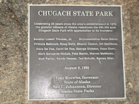
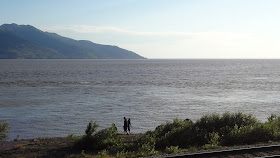
Cook Inlet stretches 180 miles from Gulf of Alaska up to Anchorage which looks surrounded by the two arms of Cook Inlet – Knik Arm on northern side and Turnagain Arm on the southern side. Just south of Anchorage, the Seward Highway hugs the dramatic shorelines of Turnagain Arm, arguably one of the most beautiful stretches of highway in America. Chugach State Park's 3000-feet mountains jut up on our left. Alyeska Mountain was 2500 feet high. We drove through this 41 miles long, scenic, four-lane Seward highway along the Turnagain Arm.
At night, I am told, the sprawling, sometimes four-mile-wide flats of Turnagain Arm seem to stretch like a plain to the opposite shores of Cook Inlet, where mammoth sloping mountains abruptly stop their flat expanse. Each turn during this drive revealed another scenic wonder.

Turnagain Arm is one of only about 60 bodies of water worldwide to exhibit a tidal bore, a tidal phenomenon in which the leading edge of the incoming tide forms a wave or waves of water that travels up a river or a narrow bay against the directions of the river or the bay’s current. Turnagain Arm sees the largest tidal range in U.S. with a mean of 30 feet, and the fourth highest in the world. The ocean’s natural 12-hour 25-minute tidal cycle is close to Turnagain Arm’s natural resonance frequency, which then reinforces the tide similar to water sloshing in a bathtub. That day, if we had waited till 10.30 PM in the night, we could have seen this very unique tidal bore phenomenon. Because of the children, we couldn’t afford to come back to Turnagain Arm to witness this.
We then reached the base station for going up the 2750 feet high Alyeska Mountain to reach the ski resort through a closed rope car. Mount Alyeska was part of the larger Chugach mountain range and the Alyeska resort is the largest ski area in the region. When we reached the base station, the first to welcome us was a swamp of mosquitoes. Yes, mosquitoes in America. Travel advisory strongly recommended carrying mosquito repellants while one travels to Alaska. We bought our tickets, got into the rope car and reached the ski station at the top, viewing on the way the scenic beauty around the hills and the valley down below. There we met a just-married couple – An African-American and a White lady at the Ski Station and took pictures with them.

The areas around the entrance to the ski resort were flat closer to the station, sloping up and down in different directions. They offered excellent opportunities to hike. Patches of snow were scattered here and there. The view was very good. We walked around, took lot of pictures, and played in the slippery snow.


We returned back to the base station and drove to Anchorage stopping over at several scenic places to take pictures of the Turnagain Arm Inlet.


We prepared dinner at the hotel room and went to sleep.

                                                                                                                        ……. To be continued in PART II