Total Pageviews

Showing posts with label Sightseeing. Show all posts

Tuesday, March 21, 2017

Zion Canyon is for hikers - Our Visit to Zion Canyon, Utah, USA

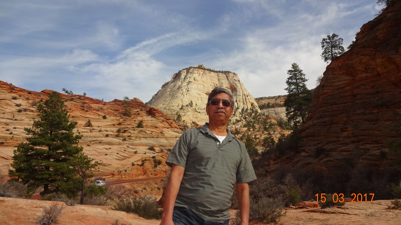
We visited Zion National Park as part of our week-long vacation. It is one of the ultimate destinations for avid hikers and mountaineers.

Zion National Park is located near Springdale, Utah in the Southwestern United States. Zion Canyon, which is 15 miles long and up to half a mile deep is located in the 229-square-mile Zion National Park and cuts through the reddish and tan-colored Navajo Sandstone by the Northfork of the Virgin River. The highest elevation in the Park is 8726 ft. The Park is home to numerous plant species as well as birds, mammals and reptiles and has 4 distinct life-zones: desert, riparian, woodland and coniferous forest. It is reported that human habitation in this area started almost 8000 years ago, with small family groups of Native Americans. To protect the Canyon, in 1909, the President of the US declared the area a National Monument, under the name of Mukuntuweap National Monument, which however got changed into Zion National Park subsequently, a name used by the local Mormon clan, to make it more attractive to tourists.
“It’s ironic, in this seemingly unending desert, that water creates most of what we see. North of Zion, rain falling on the 11000-foot-high Colorado Plateau races downhill, slices Zion’s relatively soft layers, and pushes it debris off the Plateau’s southern edge. This edge is not abrupt, but it steps down in a series of cliffs and slopes down as the Grand Staircase. Above Zion, topping the Staircase, Bryce Canyon’s crenellated edges form as water trickles off the Plateau. Below Zion, Grand Canyon forms the lowest rung into which 90 percent of Colorado Plateau waters run. Zion’s gathered waters, known as the Virgin River, traverse Mojave Desert lands and join the Colorado River in the Lake Mead’s handmade basin before completing their Pacific-bound journey.”-  From the brochure at Zion National Park.
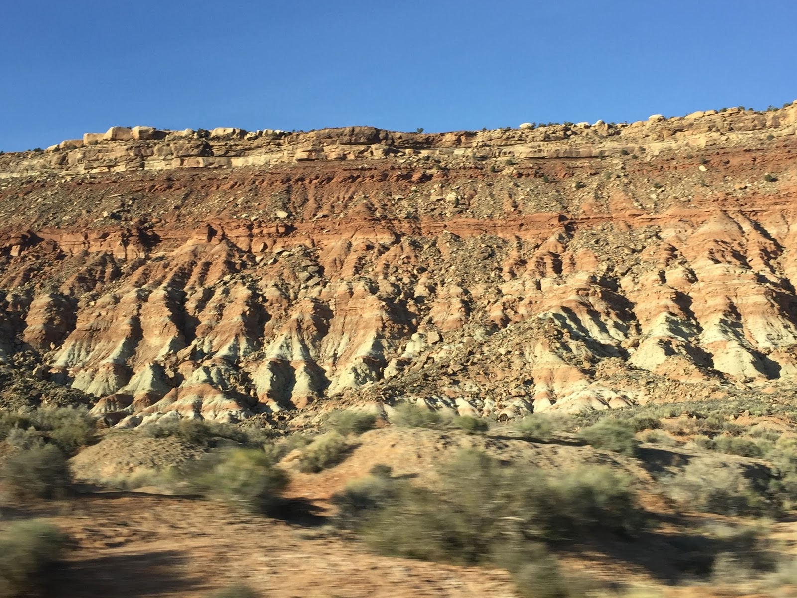
The Zion and the adjacent Kolob Canyons are marked by 9 varieties of rock formations, formed over 150 million years of sedimentation. These rock units are called the Grand Staircase.  
Here are the pictures of the different formations of rocks.
Dakota Sandstone formation

Carmel Formation

Temple Cap Formation

Navajo Sandstone formation

Keyenta Formation

Moenave Formation

Chinle Formation

Moenkopi formation

Hurricane Cliffs
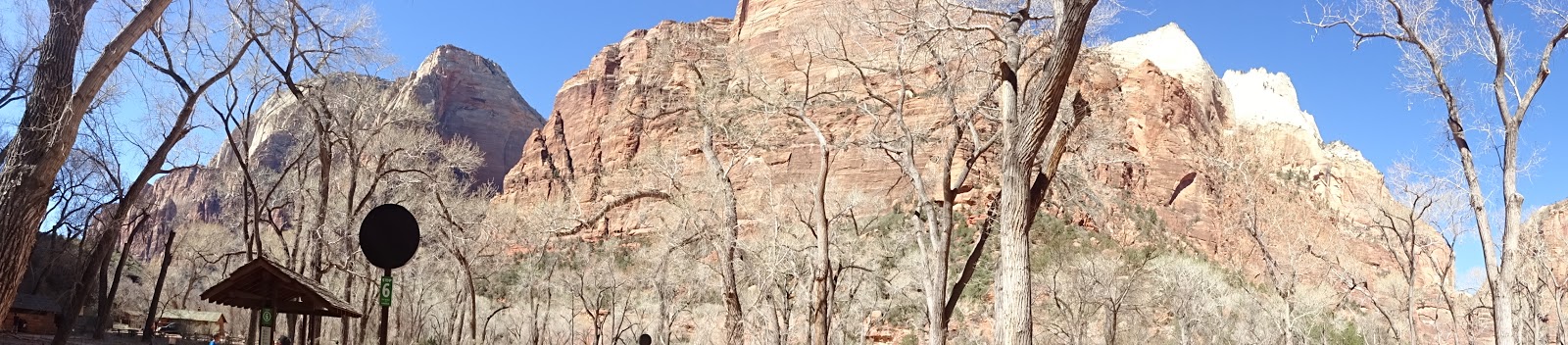
The 6-mile long road into the Zion Canyon ends at the Temple of Sinawava, referring to the Coyote God of Paiute Indians. The canyon narrows at the Temple. There is a kilometer-long foot-trail to the mouth of the canyon narrows, along the Virgin River. From there, one has to go through a 20-feet narrow gorge up 2000 feet to reach the top. The Zion Narrows through the river was closed when we visited. It is reported to be a hazardous and uncertain trek with the upstream Virgin River water stream.

The Zion National Park is served by a free shuttle service between April and October of a year, starting from the Visitor Centre all the way up to the Sinawava Temple stopping over 9 points along the way for the benefit of the hikers and tourists. The other roads of the Zion are open to all private vehicles year-round.
While moving around in the shuttle we could also see a few mountaineers climbing up the steep rocks using ropes and hooks and a few others having overnight rest on a hammock suspended from vertical rocks.
There are different trails, some easy, some moderate, and some really steep and hard. We did the easier one along the river from the Grotto as well as the paved Riverside Walk from the Sinawava Temple. Angels Landing Trail, a 5.4 miles trail with long drop-offs, the last section of which is a route along a steep, narrow ridge to the summit, often covered by snow and ice is said to be one of the most strenuous ones. In a separate blog, I am attaching a video on the Angels Landing Trail that I saw on the YouTube. Hair raising, butterfly-in-the stomach trail, really!

We also drove through the Zion-Mount Carmel scenic Highway, passing through the Carmel Tunnel. On the way we saw the notable Checkerboard Mesa and the East Temple. On our return, some of us went up a steep hike on the Canyon Overlook Trail, just before the Tunnel.
            Kolob Arch, the world’s second longest natural arch lies on the adjacent Kolob Canyon section. However, due to want of time, we couldn’t visit Kolob Canyon.
 
The weather in Zion Canyon changes with the seasons. The Spring and Autumn seem to be the most acceptable season to visit the Canyon. Summer could be harsh with scotching Sun and winter could mar the hikers’ enthusiasm with snowfall and ice. Storms during July through September may produce waterfalls as well as flash floods.  
The area had been inhabited by ancient Native Americans in the past. European exploration of the Canyon had begun only during the 18th century. Mormons had settled in the Utah areas for their mineral deposits, timber, and for grazing cattle, sheep, and horses. They had also diverted Kolob water to irrigate crops in the valley below. The Mormon settlers had named the area Kolob – to mean ‘heavenly place nearest the residence of God.’
USA does a lot to preserve Nature by declaring a number of places as National Park. Small children are encouraged to attempt a small test to get recognized as Junior Forest Rangers, and they are presented with a medallion. The infrastructure like roads, electricity, parking areas, restrooms, dining areas for picnics, ‘ramadas,’ and camping and resting areas in these National Parks are extremely good, though cell phone tower coverage is mostly not available inside the Canyon area due to elevation. Hikers will have to carry their own snacks, lunch and water, wherever they go inside the Canyon. No restaurants are available excepting at Zion Lodge Point in the middle. There are several hotels, restaurants, lodges, shops just before the entrance to the National Park.

        I thank Wikipedia and the Zion National Park Brochures for the information and some of the pictures contained in this blog.
            Here are the pictures I took:


                                                                              ....Await my final report on Bryce Canyon

Please send your comments using the Comments Box.

Sunday, March 19, 2017

Antelope Canyon

Antelope Canyon is a ‘slot canyon’ in the Southwest of North America. It is located on Navajo (pronounced as Navaho) land east of the city of Page, Arizona. (Navajo Nation is a semi-autonomous Native American Territory.)


Antelope Canyon includes two separate, scenic slot canyon sections, referred to individually as "Upper Antelope Canyon" or "The Crack" (660 feet long) and Lower "Antelope Canyon" or "The Corkscrew" (1335 feet long) and have a depth of 120 feet. The Canyons are located at an elevation of 3704 ft above MSL.
The Navajo name for Upper Antelope Canyon is Tsé bighánílíní, which means "the place where water runs through rocks". Lower Antelope Canyon is Hazdistazí, or "spiral rock arches".
Antelope Canyon was formed by erosion of Navajo Sandstone, primarily due to flash flooding and secondarily due to other sub-aerial processes. Over time the passageways eroded away, making the corridors deeper and smoothing hard edges in such a way as to form characteristic 'flowing' shapes in the rock.
Antelope Canyon is a popular location for photographers and sightseers, and a source of tourism business for the Navajo Nation.  

                                                             (Inside of the Upper Antelope Canyon)
Upper Antelope Canyon
Upper Antelope Canyon’s entrance and entire length are at the ground level, requiring no climbing. Besides, beams (shafts of direct sunlight radiating down from openings in the top of the canyon) are much more common in the Upper than in Lower Canyon during the summer months.

Lower Antelope Canyon

                                                                 (Inside of Lower Antelope Canyon)


                                                        (Stairs leading out of Lower Antelope Canyon)
Lower Antelope Canyon is located a few miles away. Metal stairways have now been installed to go into the canyon. It is in the shape of a "V" and shallower than the Upper Antelope.
Flash flood danger
Antelope Canyon is visited exclusively through guided tours, in part because rains during monsoon season can quickly flood the canyon. On August 12, 1997, eleven tourists were killed in Lower Antelope Canyon by a flash flood.  At the fee booth, a NOAA Weather Radio from the National Weather Service and an alarm horn are now stationed. Despite improved warning and safety systems, the risks of injuries from flash floods still exist. A flood occurred on October 30, 2006, lasting 36 hours had caused the closure of the canyon for 5 months by The Tribal Park Authorities. On July 30, 2010, several tourists were stranded on a ledge when two flash floods occurred at the Upper Antelope Canyon. 
Horseshoe Bend
Besides the Antelope Canyon, we also visited the Horseshoe Bend, offering a spectacular view of the river Colarado flowing down a canyon. The pictures shown here will speak for themselves.


(I thank Wikipedia for some of the information I have given here in the blog.)

Friday, August 19, 2016

Our tour to Ladakh - An Introduction


18th August 2016

Sometime in May/June, this year, I was scrounging the internet for a Europe trip on our way back from the USA during June. However, my better-half threw cold water on my plans, citing her troubled knees and our long absence away from our home in India. However, I deftly managed to strike a deal with her that she wouldn’t object to a trip within India sometime during August. So, I was seriously searching the internet for a trip to Gujarat/Gangtok/Nepal, the places we had yet to explore and suddenly, an ad for a package tour to Ladakh (promoted by Thomas Cook India) popped up from nowhere. Immediately on glancing through the ad, I knew that Ladakh was the place we would be visiting, on our return to India. I seriously researched on a trip to Ladakh and collected some basic details.

Ladakh is a high altitude desert on the Himalayas and a part of the State of Jammu and Kashmere. The place, being a rain shadow area, is generally bereft of rains and green vegetation. The altitudes range from 9000 feet to 22000 feet resulting in low oxygen availability that visitors could be highly susceptible to the High Altitude Sickness, including breathing trouble. June to September is generally summer time there. The Ladakh region shares its international borders with both the Tibetan China and Pakistan. Leh and Kargil are the two main centers in Ladakh, and the population is divided between Muslims and Tibetan Buddhists, generally. Tourism happens to be the main business, lasting mostly through the summer months only. Winters could be extremely cold with snow fall. The Border Road Organization is doing a tremendous job, maintaining the roads in the most difficult conditions and terrain. The entire region seems more or less under the control of army, as one could see the army camps, units, and their movements almost everywhere. Indus is a major river in the upper Leh area and Zanskar is another important river.

Armed with the preliminary information, I searched for other tour packages too. I concluded Thomas Cook India and MakeMyTrip.com, both, offered decent tours. The costs were similar. I settled for the Thomas Cook package as it included the trip to the most attractive, high altitude, blue-water-lake at Pangong. I paid the initial advance for the tour from New Delhi. The package included flight from New Delhi to Leh and return, hotel accommodation, morning breakfast, dinner at nights, lunch for three days, pick-up and drop from and to the airport at Leh and transportation for the sightseeing places – lasting 7 Nights/8 Days. The tour included Leh, Nubra valley and Pangong Blue Water Lake.

The high altitude of Ladakh scared my wife, and she was quite apprehensive. Yet, she okayed the trip, for I knew she also loved traveling and seeing places. After all, we may have only one life, and we must see as many places as possible when we are still healthy and when our mobility is not seriously hampered by all sorts of ailments. This is my belief. Traveling and sightseeing is one of my favorite hobbies. We also read about a few scary details about the Ladakh region – landslides, rough road conditions, border troubles, lack of telecommunication facilities, inaccessibility etc., -  and we started making preparations.

Torch light, umbrella, medicine for every known common illnesses like throat infection, back-pain, diarrhea, acidity, cold and flu etc., Diomax for high altitude sickness, winter clothing, snacks, etc., etc. Importantly, converting my BSNL prepaid mobile phone connection to Postpaid. BSNL was the only reliable service provider in Ladakh, it seemed.

Thomas Cook India didn’t send me the tickets, vouchers and other details well in advance and contended that it was their policy to send them only three days before the commencement of the tour. After a series of complaints and telephone calls to their Toll Free numbers, pointing out that I lived in a remote corner of Tamil Nadu and I didn’t intend to travel by flight to Delhi and that I didn’t wish to undertake a travel to Delhi without knowing anything about the tour, finally, they sent me the details a day before I left Tenkasi, where I live.

I travelled by the train to Chennai and then to New Delhi. After all, I have plenty of time with me and I don’t have to rush to reach Delhi by air. It saved money for me too. After a day’s stay in an OYO hotel in Karolbagh, New Delhi on the 6th, finally we were there at the New Delhi airport on the 7th early morning to catch our flight to Leh. There began one of the memorable and enjoyable ever trips we had undertaken in the last several years.
                       

                                    To be continued……..